 What is it about this area that makes us get sundowners? Can you explain how the winds work? —W.
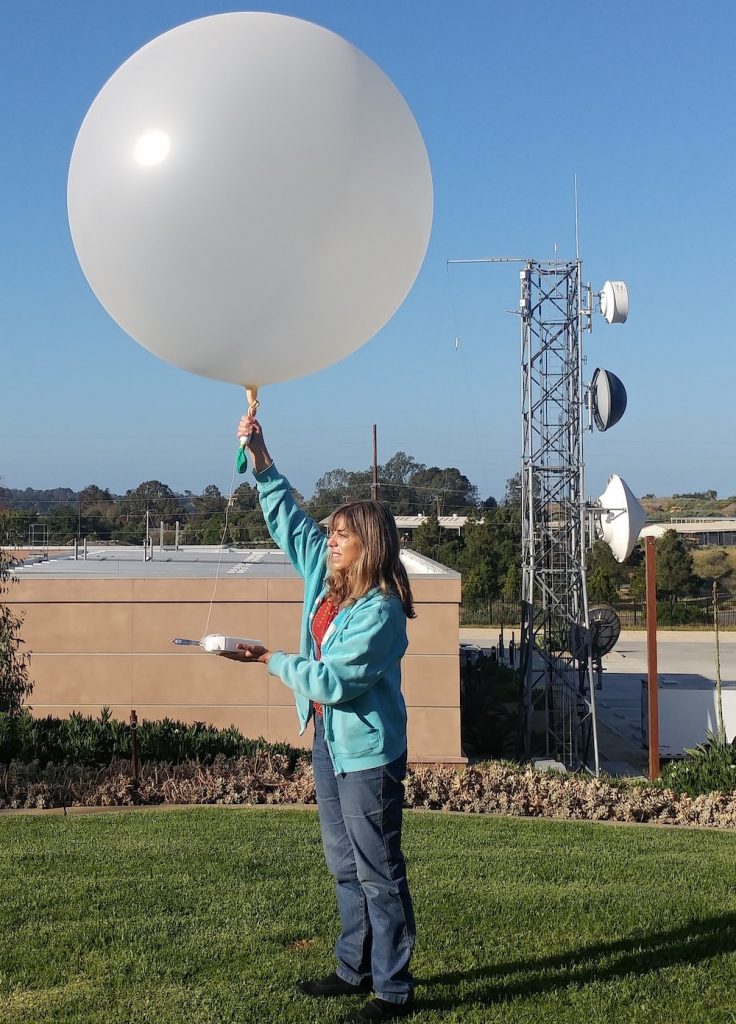
“Sundowners have been my main topic of research in the last few years,” said Dr. Leila M. V. Carvalho, professor of meteorology and climate sciences at UCSB. She kindly agreed to explain the science behind the winds. (Right: Dr. Carvalho launching a weather balloon as part of her studies.)
···············
If you live on the southern slopes and foothills of the Santa Ynez Mountains (SYM), you probably have experienced evenings with gusty and dry winds, capable of knocking down trees and power lines, blowing your outdoor furniture, or causing you to stay awake due to the noise. We call these winds “sundowners” because they tend to intensify right after or around sunset in most of the southern slopes of the SYM. Sometimes, particularly in the eastern parts of the SYM (east Santa Barbara and Montecito), these winds become stronger late in the evening and until early morning.
Why do we have sundowners? First off, Santa Barbara has a few unique features that make these winds unique: a) the east-west orientation of the SYM; b) the fact that the SYM rise abruptly from the coast, separating the cool Pacific Ocean from the Santa Ynez Valley; c) the San Rafael Mountains in the back country, which have several peaks that are about twice as high as the highest peaks in the SYM. The San Rafael Mountains merge with the SYM in the east, giving the Santa Ynez Valley a “V” shape. Moreover, elevations in the SYM increase from west to east, and there are numerous passes and canyons that play significant roles for the intensification of the winds and their spatial variability. All these are natural aspects that need to be taken into account to understand the variability of winds in Santa Barbara.
Winds are the result of differences in sea-level pressure. Winds always blow from high to low pressure, never the opposite. So, in order to observe strong winds, it is necessary to have strong pressure differences on short distances (or pressure gradients). In the case of sundowners, weather systems must favor northerly winds (winds blowing from north to south—or winds that are mostly perpendicular to the SYM). The National Weather Service (LA/Oxnard) relate these winds to differences in sea-level pressure between Bakersfield Municipal Airport and Santa Barbara Airport, and between Santa Maria Airport and Santa Barbara Airport, with the highest pressure always observed either over Bakersfield or Santa Maria. Greater differences are generally associated with stronger sundowner winds
The presence of a cool ocean is important in our region because during the day land warms faster than the ocean and the cool oceanic air (which is denser) advances over the coast. Thus, the onshore winds (or sea breezes) oppose the northerly winds. Sometimes, even when the northerly winds are strong aloft, the cool air from the ocean can be strong enough to oppose the northerly winds, and those living near the coast and foothills of the SYM will experience light winds during the day, even when northerly winds are really strong aloft. The Santa Ynez Valley, on the other hand, acts in a different way. A hot valley means more ‘convection’ there, bringing warm air from the bottom up and mixing the air really well. The consequence of this mixing is that winds can be really calm for about 3000-6000 feet above ground level. These heights can exceed the SYM crest level, resulting in light winds during the day on the slopes of the SYM.
The San Rafael Mountains can become an important barrier for the winds, particularly when winds blow from north-northeast to south-southwest direction during the day. In this case, winds will be strong at elevations that are above mountain crest and we observe generally lighter winds during the day on the slopes and/or foothills of the SYM. After sunset, however, winds accelerate over the slopes of the Santa Ynez and San Rafael Mountains, flowing like a river from north to south, really close to the slopes of both mountain ranges. These winds are accompanied by gusts and this is the moment that we recognize them as sundowners. Sundowners blowing from the mountain to the coast can cause very dry conditions south of the Santa Ynez Mountains. Sometimes, depending on the season or during heat waves, these winds can be really hot during night time (although less common, temperatures above 90ºF have been observed in some conditions during heat waves around 8-10 p.m.). Air descending the mountain can increase temperature and decrease relative humidity. The decrease in humidity is, in fact, what seems to be the most relevant signature of sundowners.
Downslope winds are actually observed every evening, when the slopes of the mountains begin to cool. The cool air is denser and tends to move downslope. If there is no strong pressure differences, these will be light winds. We call them “mountain breezes.” Those living in mountain areas are likely familiar with these periodic light downslope winds.
Strong offshore winds are more common in the western SYM (region of Gaviota and Refugio) than in Santa Barbara and Montecito. However, when conditions are favorable, sundowners can be really strong and cause even stronger gusts in the east than they cause in the west. This is because of the height of the mountains in the east and consequent effect in the intensification of winds.
Sundowners are particularly scary during the wildfire season, which now extends year-round. In fact, sundowners have been responsible for the fast spread of all major wildfires that affected populated areas in Santa Barbara, including the Painted Cave fire (1990), the Jesusita Fire (2009), the Tea Fire (2008), the Thomas fire (2017), the Holiday Fire (2018), and the Cave Fire (2019)….
···············
Previous Burning Questions:
••• Why Is There a Pressure Cooker Attached to This Utility Pole?
••• What’s This Concrete Ramp Thing on East Beach?
••• Why Does “USA” Get Written on the Street?
••• What Are Those Poles in the Ocean Near the Ritz-Carlton Bacara?
••• Are People Really Allowed to Set Fires in the Middle of Montecito?
••• What’s the Story With the Half-Finished Lot Next to the Montecito Country Mart?
••• Is the Bridge Over San Ysidro Creek Ever Going to Get Repaired?










Greetings,
I was on the south side of Santa Rosa Island, at Johnsons Lee, on 9/5-9/7. A very dry hot wind blew in every evening dying out at about 2:00AM. The first day it started at 8:00 and then each day got earlier. On 9/7 the hot wind started at 2:00 PM. 9/6 was the hottest, with the temp over 95. Was this all Sundownders coming from Gaviota? Just trying to understand the weather. Thanks, Julius